File:Map-island.png
Jump to navigation
No higher resolution available.
Map-island.png (782 × 467 pixels, file size: 629 KB, MIME type: image/png)
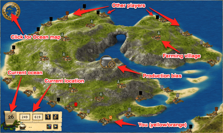
Example island map
File history
Click on a date/time to view the file as it appeared at that time.
| Date/Time | Thumbnail | Dimensions | User | Comment | |
|---|---|---|---|---|---|
| current | 03:35, 17 March 2011 | | 782 × 467 (629 KB) | Aubergine10 (talk | contribs) | forgot to annotate it |
| 03:27, 17 March 2011 |  | 650 × 388 (581 KB) | Aubergine10 (talk | contribs) | Example island map |
You cannot overwrite this file.
File usage
The following page uses this file: