File:Map-travel-time.png
Jump to navigation
No higher resolution available.
Map-travel-time.png (593 × 461 pixels, file size: 473 KB, MIME type: image/png)
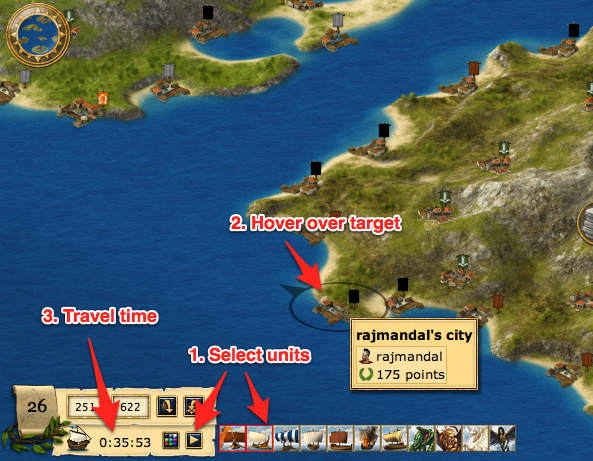
Shows how to calculate travel time using the island view map.
File history
Click on a date/time to view the file as it appeared at that time.
| Date/Time | Thumbnail | Dimensions | User | Comment | |
|---|---|---|---|---|---|
| current | 00:09, 17 March 2011 | | 593 × 461 (473 KB) | Aubergine10 (talk | contribs) | Shows how to calculate travel time using the island view map. |
You cannot overwrite this file.
File usage
The following page uses this file: